Truckee
To see details of this section:
We left Quincy after two nights with wonderful Warmshowers hosts Shane and Jim and continued on our way. We turned off highway 89 at Graeagle to head up to the lakes basin area. Everyone who we chatted to at the store in Graeagle could not believe we were planning to ride up there so we set off on the climb with some trepidation. The reality was that it was fine.
I say fine, what that means is that it was 9 miles in our lowest 2 gears and about 2.5 hours of climbing. We rested lots and cooled down by wetting our cycling shirts in the creeks we passed.
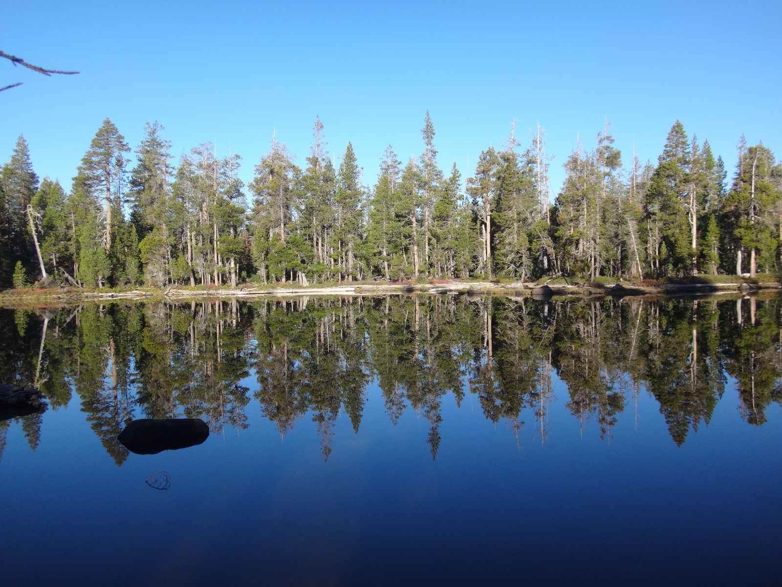
We camped at Goose Lake and had the campground to ourselves. Lovely sun over the lake.

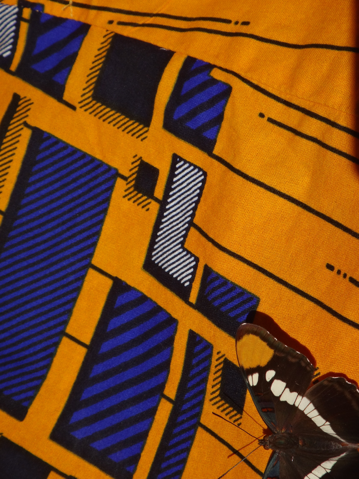
There was a butterfly that was particularly attracted to my shirt. Perhaps because of the colour match?
Not too chilly in the night and beautiful morning sun on the water.
Down, up, down into Truckee. Mainly on route 89 which was nothing special. The excitement of the afternoon was seeing white in the sky, as we got closer it became apparent that it was a fire. We were unsure if we should continue riding towards it but figured a passing car would warm us if necessary. Eventually passed a sign saying it was a controlled burn. The Forest Service to these in order to manage the forests (better to have controlled small burns than out of control devastating burns)
Staying with another warmshowers host in the cabin in their garden (complete with bear protection!)
A few words on route planning (inspired by a comment from my dad)
There are many variables when planning a tour like this and I don't think it is possible to do it perfectly. Planning operates at many levels, from the macro: we are heading south, to the micro: we turn left at the T junction in town. Between those, there are other decisions to make. For example in Oregon we had a choice to either stay on the coast or to head inland. It was not straightforward as there were pros and cons to both. Having made it choice, we then had to plan which destinations we would include.
This is usually done by a scan of Google maps looking for state parks, interesting features etc. We supplement this with information/ideas from people we chat to and begin to sketch out a rough route. Quite often this takes us to great places by chance (the Lava Beds park is an example of this).
We also make smaller scale amendments to our route based on things we read about/hear about from folk we chat to. For example the trip to Burney Falls was inspired by two random conversations with strangers. Likewise the detour via the Lakes basin was informed by our warmshowers hosts Shane and Jim.
The most micro scale of decision making its when we look at the map on our phones and see a side road next to the highway. We always turn off and take these to get away from traffic and to see a slice of local life.
All in all, route planning is not an exact science. It pays to be flexible in thinking and to listen to advice (and don't be put off by naysayers who are not cyclists!)
Let me know at miketoyn@gmail.com if you would like an email update whenever there is a new blog post. Also remember that we have stuff on Instagram https://www.instagram.com/two.boldlygo/
.JPG)
.JPG)
Sounds like good progress! I agree with the butterfly... it is a great shirt! Nice to hear a bit about your route planning. I was wondering. Thanks fo the updates x
ReplyDelete